While we were staying in Mammoth Lakes, we took a few quick trips to some nearby attractions, notably Mammoth Mountain, Hot Creek Geologic Site, Earthquake Fault, Inyo Craters and Minaret Vista. Each of these was less than about 10 miles from our RV Park.
The city of Mammoth Lakes has several distinct sections. While its is fundamentally a ski town that also caters to summer outdoor enthusiasts, there is a sufficient year round population to support some non-tourist businesses, at least one hospital, and a TK-12 school system.
In addition to a small central business district, there is a second commercial area called the Village at Mammoth that is essentially part of the Mammoth Mountain Ski Area, even though the actual ski slopes on Mammoth Mountain are about 4 miles down the road. This area has shops, restaurants, hotels and a central plaza at which community events are held. The entire town is serviced by a shuttle bus system which connects the various sections with each other.
South of the town itself is the collection of lakes for which it is named. We did not get a chance to visit the lakes on this trip.
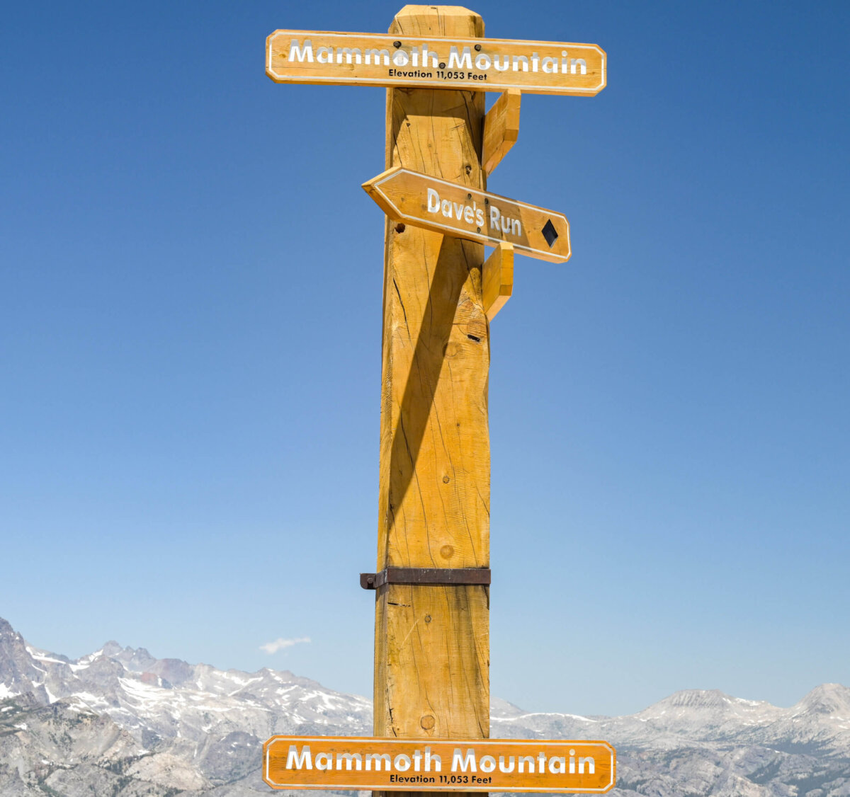
In the Ski Area, there are multiple lodges, a number of ski slopes and lifts, and an Adventure Center which offers alternative activities for those who do not ski or who choose to visit in the summer. The Adventure Center also offers gondola rides to the top of Mammoth Mountain, an offer which I of course accepted.
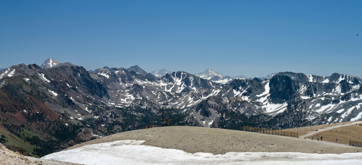
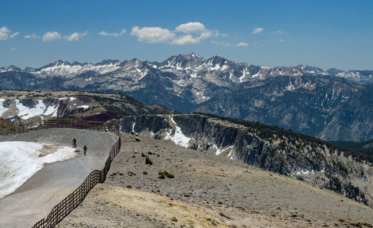
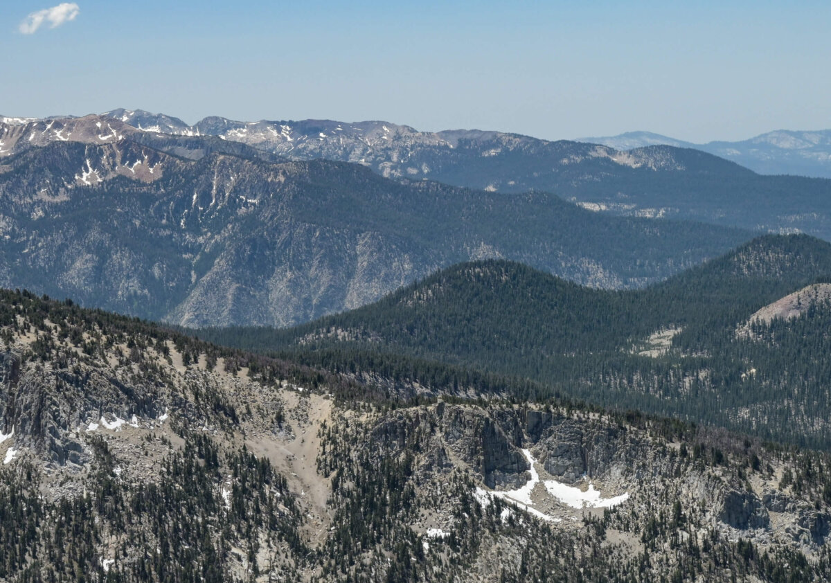
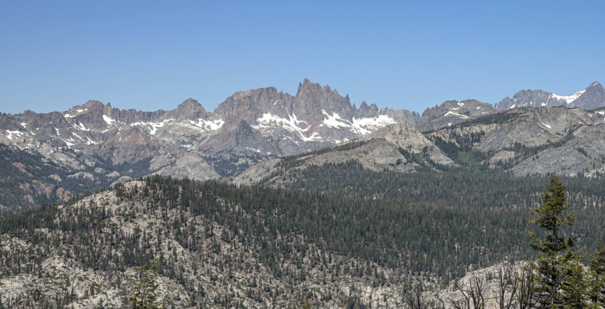
There are hiking and biking trails at the top of the mountain and a multi-level cafe with indoor and outdoor seating. There is of course also the opportunity to wander around at the top of the mountain, taking in the panoramic views at 11,000 feet or enjoying the remnants of snow still covering parts of the summit.
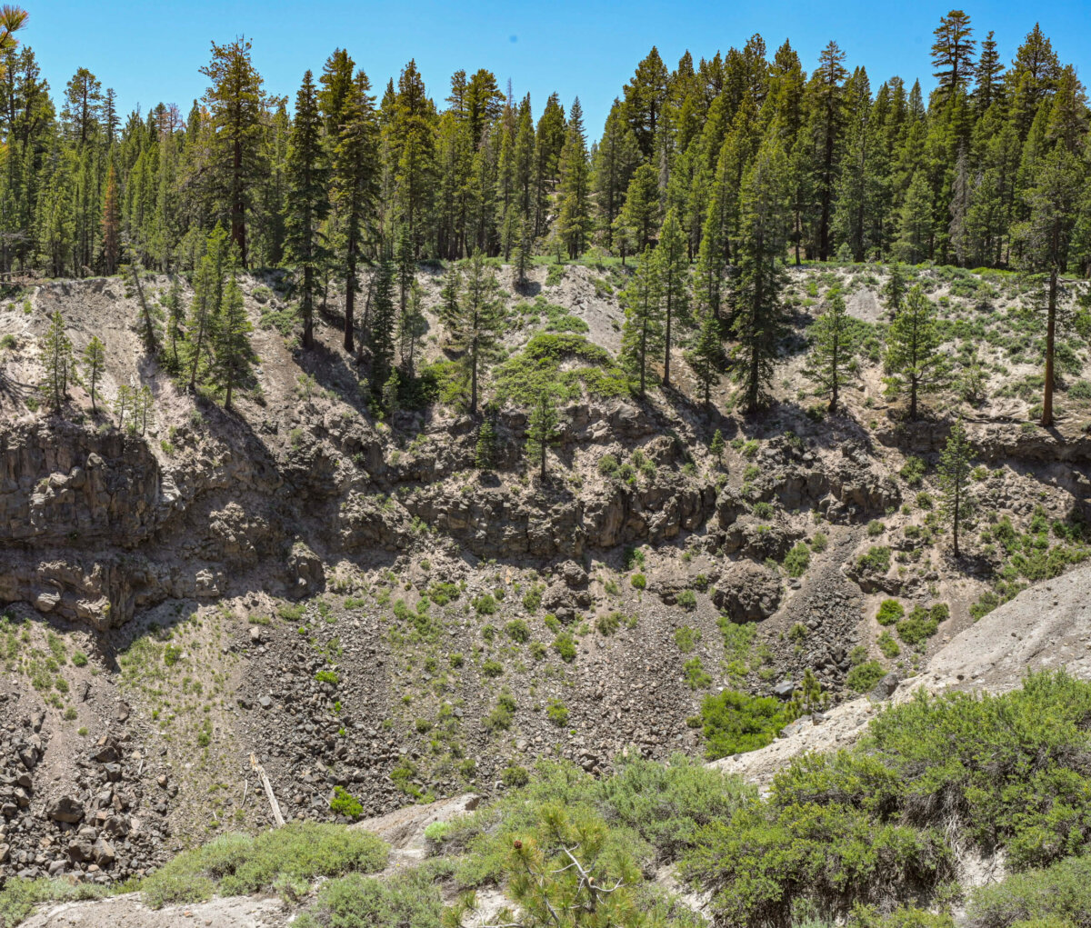
Below are three shots from the summit of the same general area. In the other direction, the Minaret series of peaks are visible, which I photographed from another, closer overlook. That photo is included later in this post.
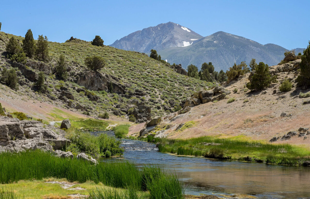
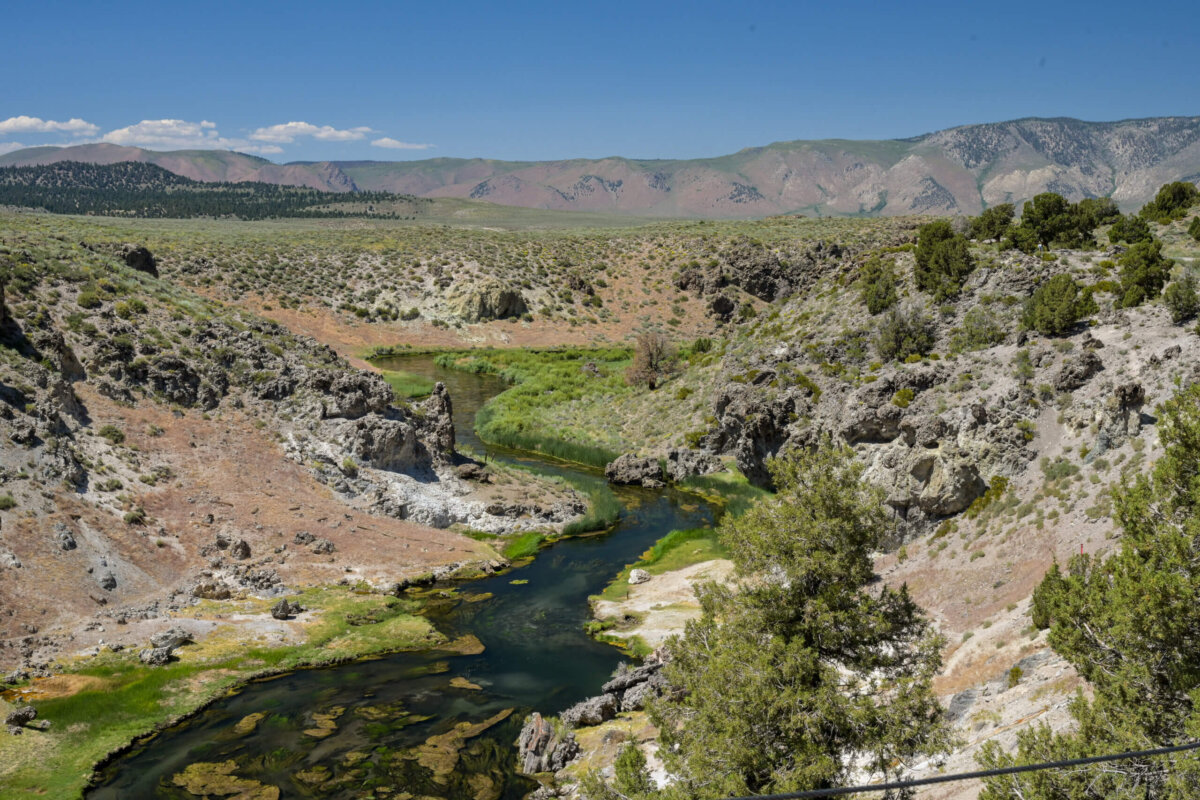
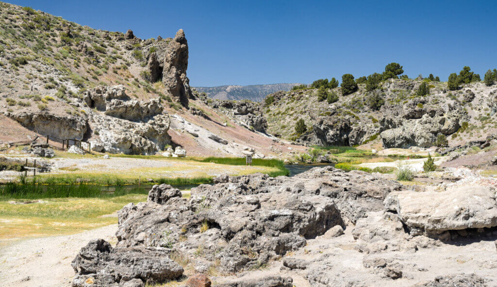
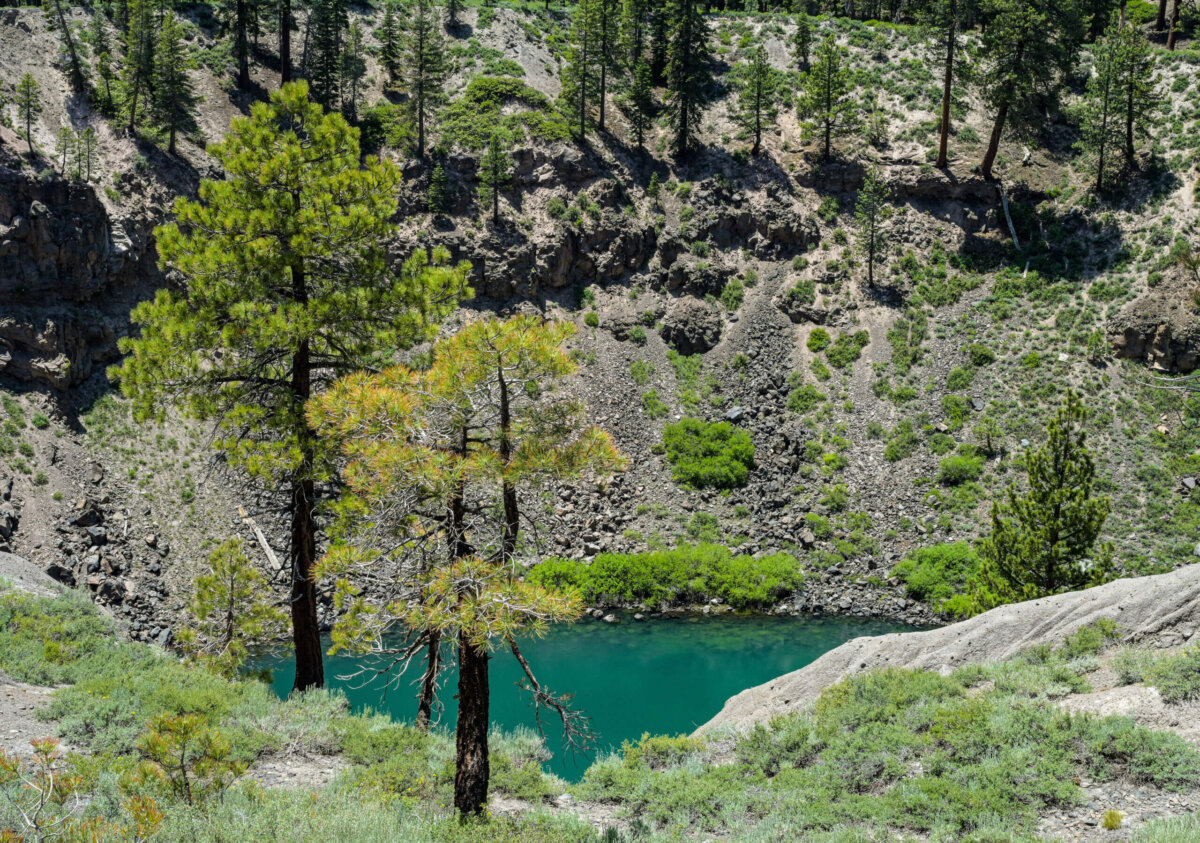
Later the same day, we visited an active geologic site called Hot Creek. It is located within the Inyo National Forest and managed by the US forest service. The water in this particular section of the creek is very hot, and reportedly can get up to 200 degrees hotter in seconds. Occasional geyser-type explosions have occurred and the water is known to boil and create steam from time to time.
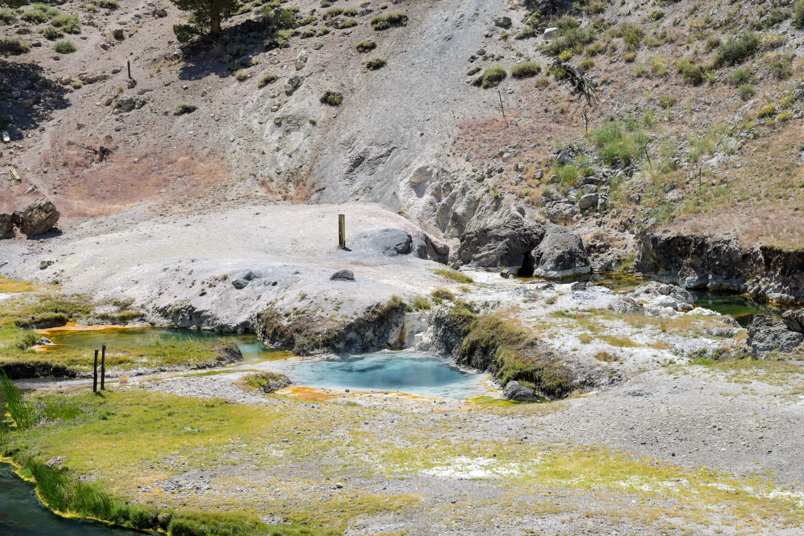
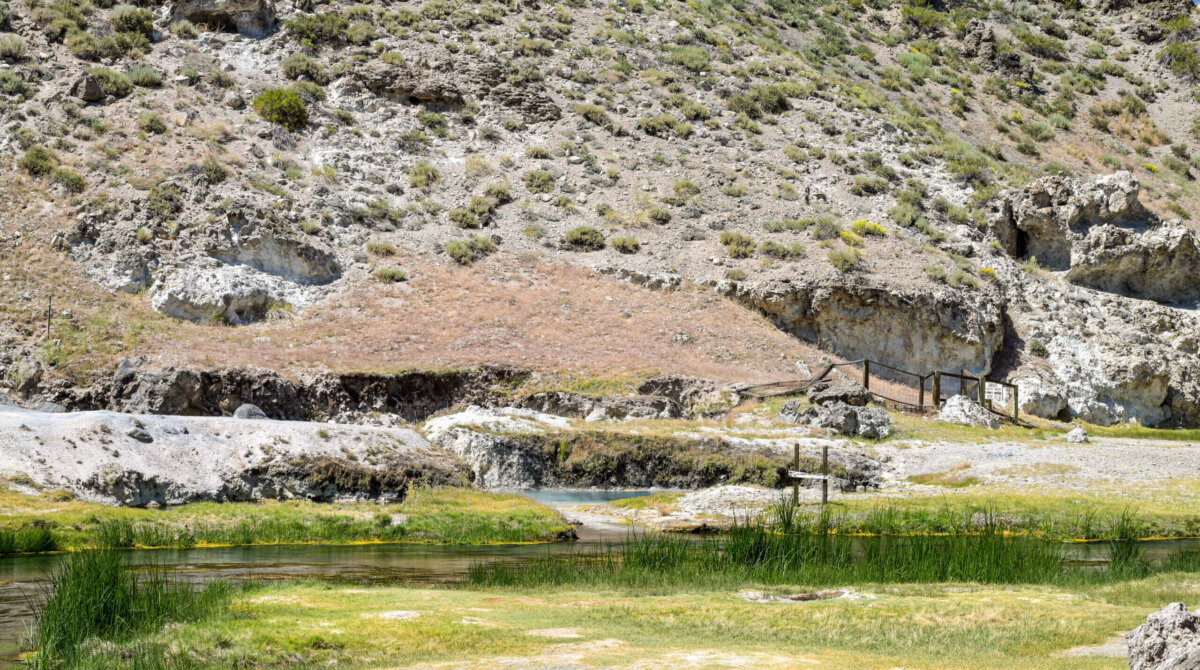
While we were at the site, things were rather subdued, and it appeared that part of the active geothermal area had been blocked off. There were lots of warning signs about the danger of getting closer than 10 feet from the banks of the creek; apparently at one time people were permitted to get into the geothermal pools (see photo below) but that activity has been prohibited, seemingly due to the risk of the water occasionally becoming so hot and pressurized that it erupts.
In any case, it was a fairly small but rather fascinating area, with a ramp leading down from the parking area to a paved path which ran along the creek below. The stream was an odd shade of green and the single very hot pool was turquoise with obvious steam visible in spite of the outdoor temperature being close to 80 degrees.
We were unable to visit two frequently mentioned attractions in the Mammoth Lakes area due to road construction, but I did want to mention them as they both looked very interesting to me. Just beyond the Mammoth Mountain Ski area are Devil’s Postpile National Monument and Rainbow Falls. Devil’s postpile is a seriously odd rock formation; it consists of a group of vertical structures that resemble fence or deck posts, at least from photos I’ve seen. Rainbow Falls is a waterfall that refracts sunlight at midday to create a rainbow effect.
Instead of visiting these two attractions, we instead went to Minaret Vista, which is basically an overlook for views of the Minaret rock formation; Inyo Craters, where a hiking trail leads to a series of craters, and a place called Earthquake Fault, which is exactly what its name suggests and involves a very short walk from the parking area.
From the Minaret Vista, we headed to the nearby Earthquake Fault. There was a short trail on either side of the fault, and steps were built into several of the shallowest spots to allow visitors to get from one side to the other. It was a bit dark in the woods and inside the fault itself, so I didn’t get great shots.
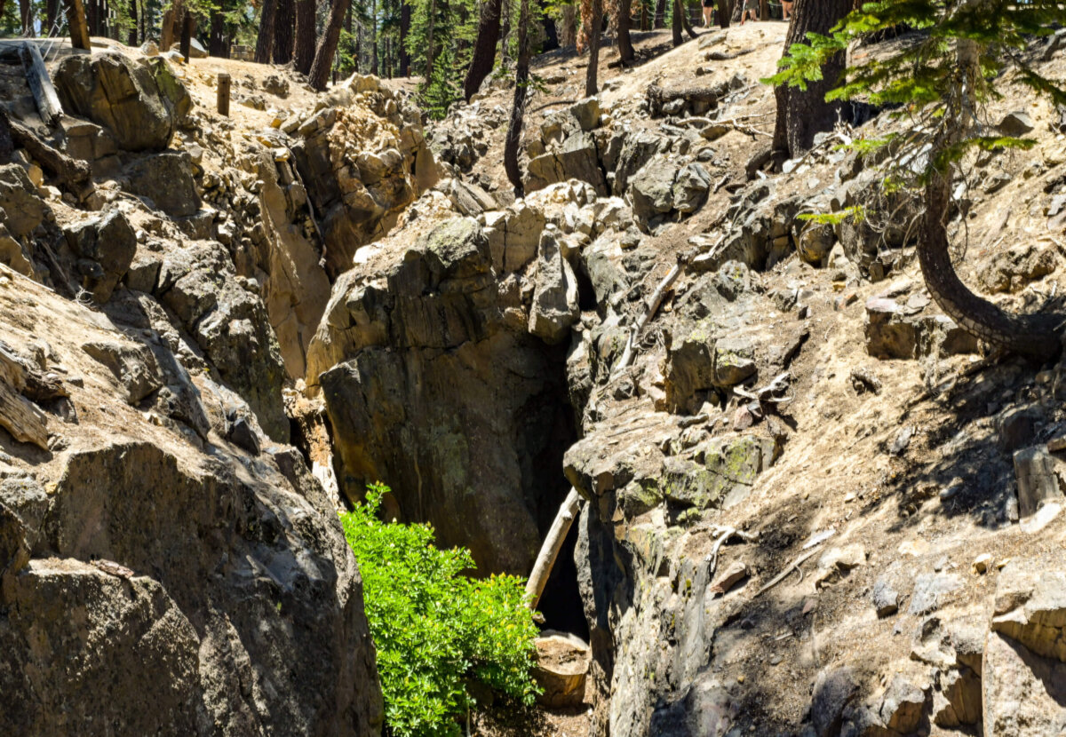
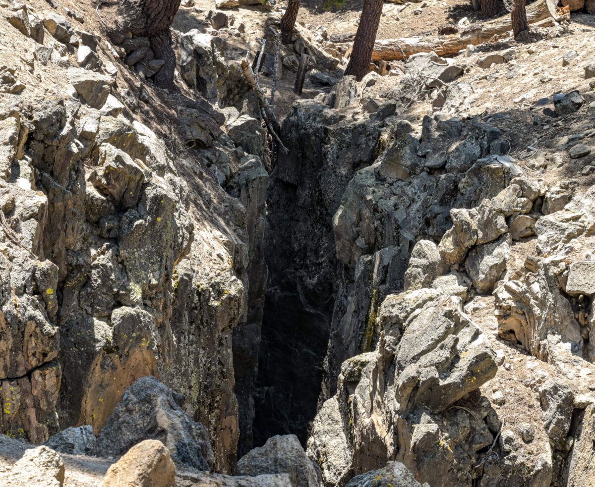
Neither of these photos are particularly good or revealing and for that I apologize. Basically I learned that a fault is a break in the earth’s crust which allows groups of rock to move relative to each other. Pressure can build, creating an earthquake. There are different types of faults, based upon the direction of relative movement of the rocks. And that’s as deep into seismic science as I care to get.
Finally, the Inyo Craters. It was warm and the hiking trail was mostly uphill, so we didn’t go beyond the first of three craters that this trail visited. The others were higher up the mountain and may have been more dramatic; still, I enjoyed getting to see at least this one up close.
Coming soon, our final stop on this trip: Lone Pine and the Western Movie Museum (lots of “Westerns” were filmed just outside Lone Pine), Mt. Whitney (the shyest and tallest peak in the continental US) and the amazing Alabama Hills.
I found your eloquent narrative and beautiful photos led me to imagine and contemplate the powerful forces and the world below the surface of this magical planet which we call hone,