Warning: This post will be about our visit to Kings Canyon, a national park located in California, This means it’s time to geek out about ROCKS! Lucky for you, I was only there for one day and thus did virtually no research. So, this post will be heavy on the photos, and light on the details.
I had no idea prior to moving west how much I would come to appreciate geology as a result. But, when you travel out here in an RV, you seem to visit lots of state and national parks. And let’s face it, while these wonderful places may often tell the stories of indigenous people, or examine the flora and fauna native to a particular area, most of the time, its really all about the rocks! To be a bit more precise, its all about the interaction of water and the rocks.
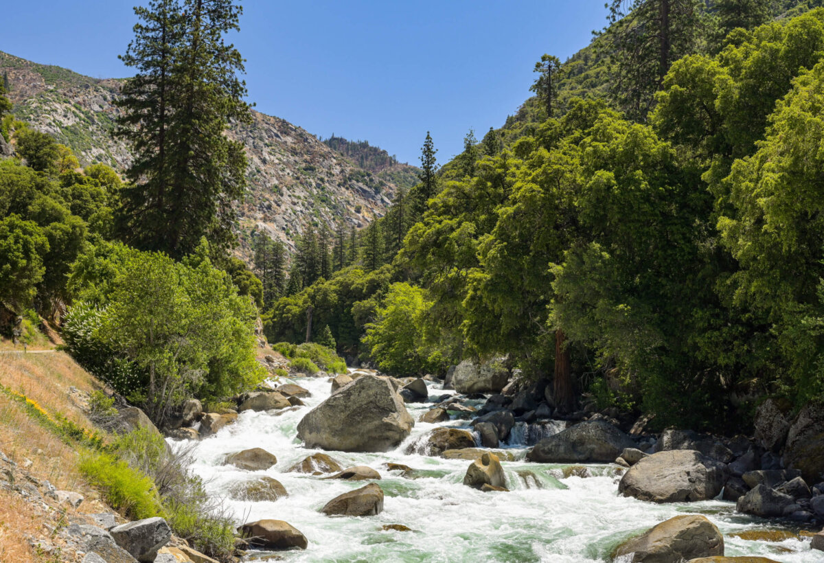
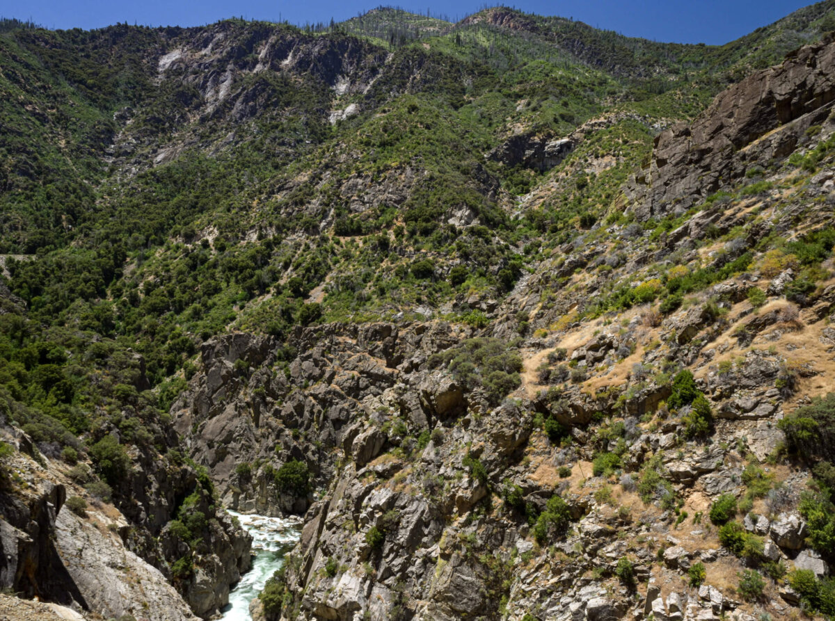
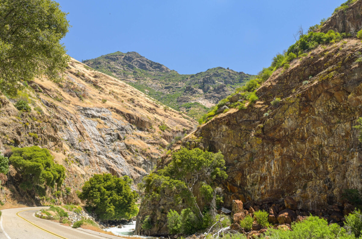
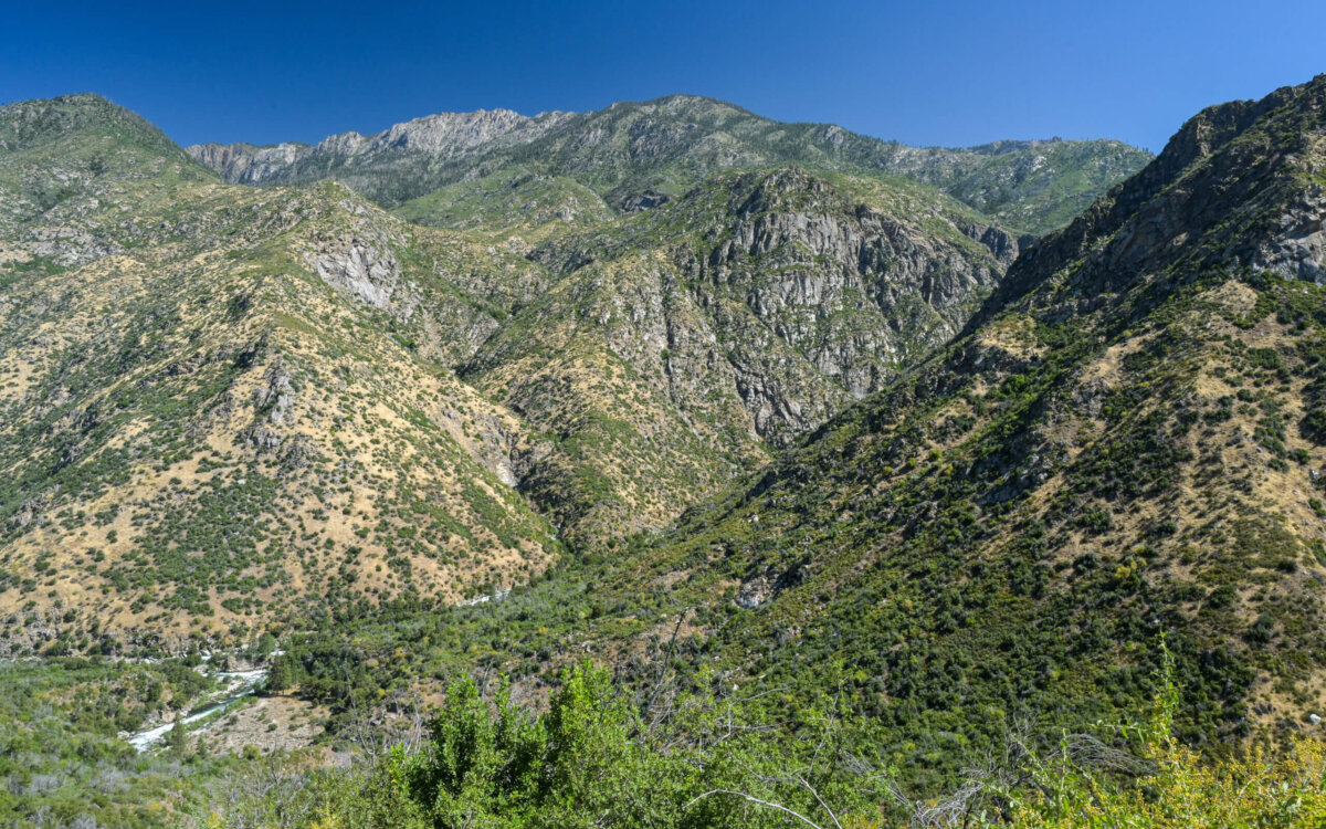
This is very much the case at Kings Canyon National Park. We had visited Sequoia and Kings Canyon last June, but there was a section of the park, where the Scenic Byway passes through the canyon, that was inaccessible due to a prolonged seasonal road closure. This year we returned a bit later in June to explore the section we had missed. The Kings Canyon Scenic Byway follows the path of the Kings River from its (the Byway’s) beginning near the entrance to the park to its end in the the Sierra Nevada Mountains at a base camp for those wishing to continue on foot into the wilderness.
From an elevation at the park entrance of between 3,000 and 4,000 feet, the road climbs fairly rapidly to an elevation just under 8,000 feet and then descends a bit more gradually to the canyon floor, which lies at about 2100 feet. This 30 mile section of the Byway includes two small commercial areas, each of which has a modest hotel restaurant and store.
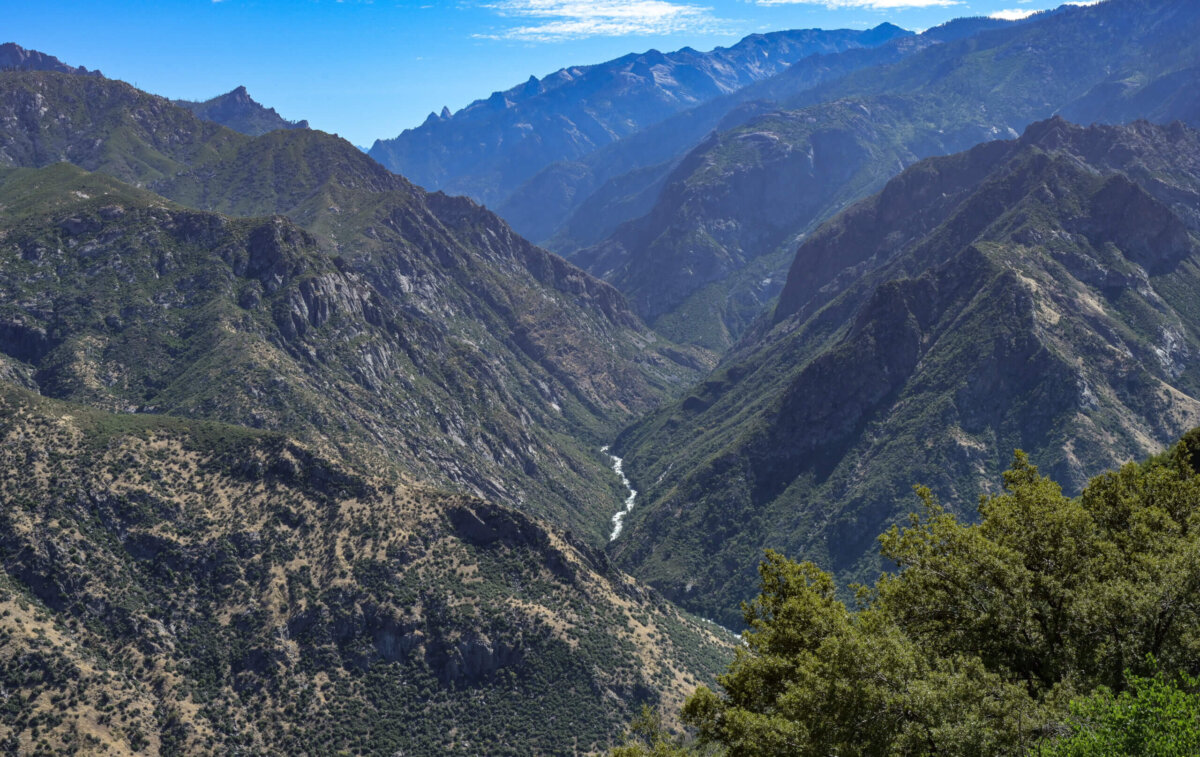
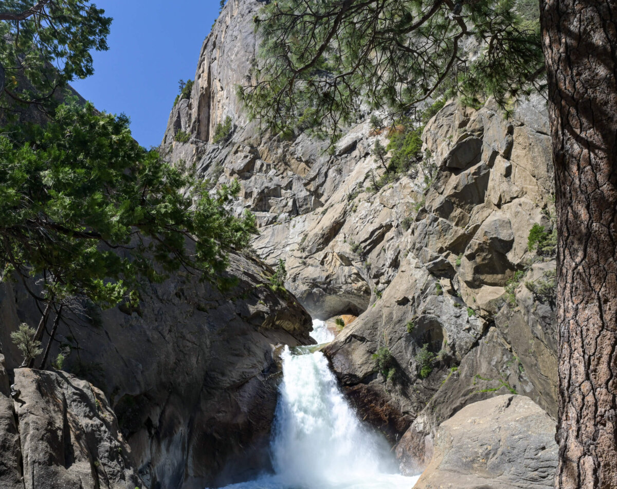
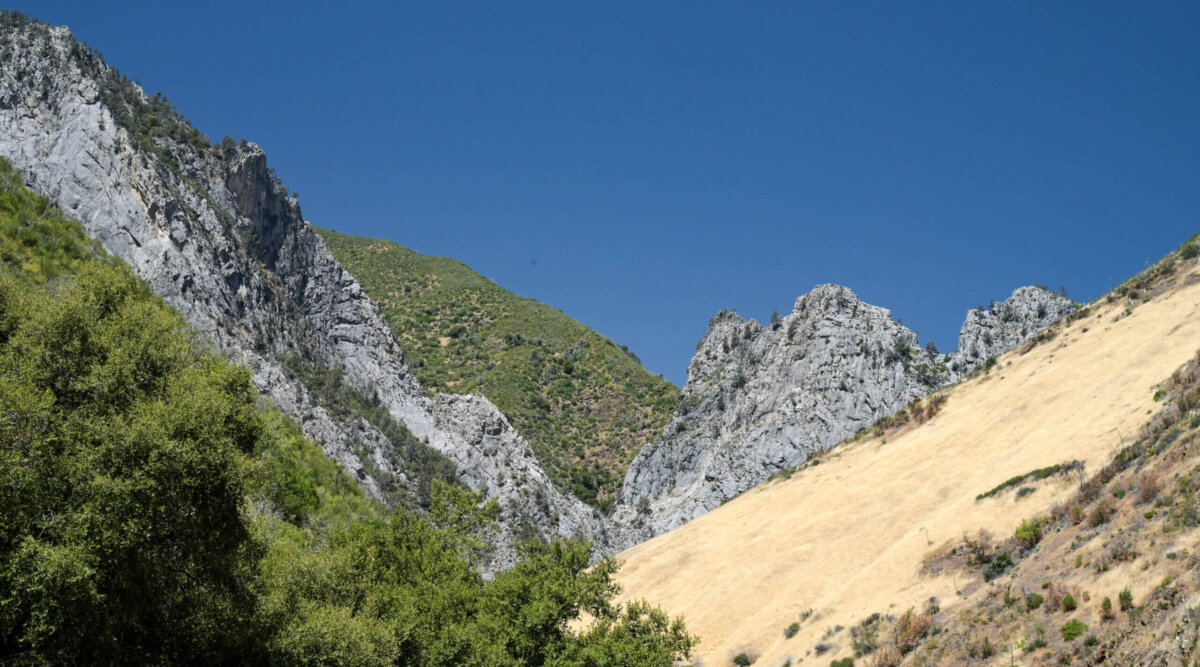
Along the Scenic Byway, there are periodic turn offs for viewing water falls, rock formations etc. There is apparently a point along the route at which the canyon is actually deeper than the Grand Canyon. Unfortunately I was unable to determine from the limited information and signage available where that point might have been. We simply pulled over where things looked interesting and I took pictures of what I saw.
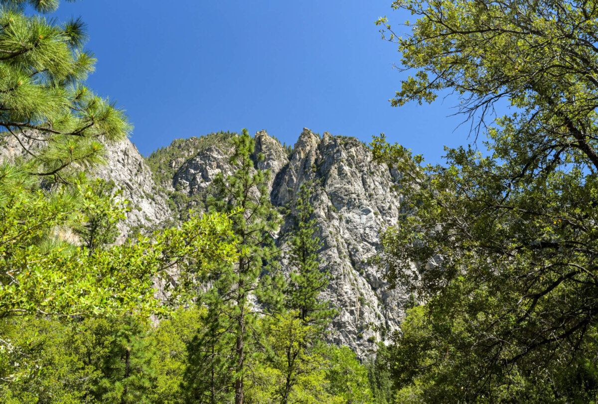
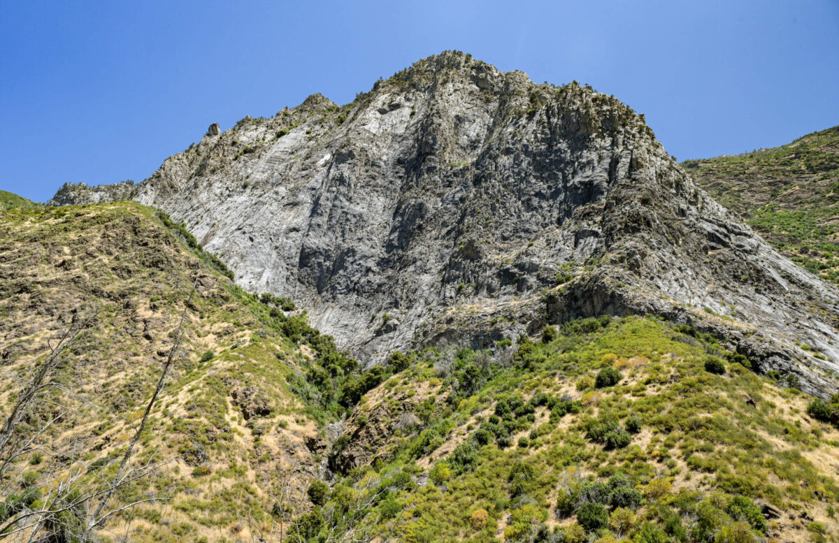
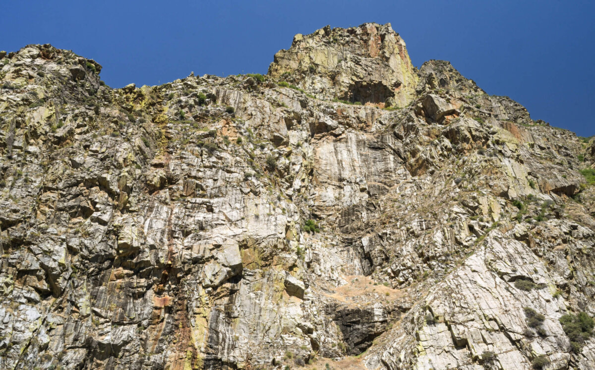
Nice shots. The two eyes associated with mouth rock kind of freaked me out.
John,
I didn’t really notice the eyes (shame on me) until you mentioned it and now I totally see them and I concur with your assessment. They freak me out a bit too. I wonder if there is a cave up there. There is probably a rock climber somewhere who knows the answer to that question; while I am curious, there is nothing on this earth that would tempt me to climb up there and find out.
Beautiful country. Your photographs are wonderful. Thank you for sharing!
Hey Vicki,
Thanks for following along. Sorry for the delay in acknowledging your comments. It has been absolutely beautiful and inspiring. There is lots more to come.
Leslie
Beautiful photos, and aptly named the mouth rock with the freaky eyes and even a bit of a broken off nose. I have been to Kings Canyon in the late fall during a dry year. Your shots are significantly greener than I remember.
Raphael,
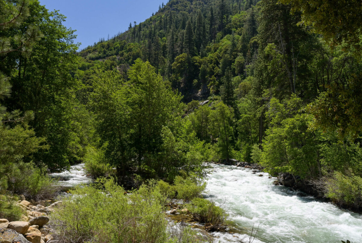
So sorry for the delay in acknowledging your comments. Thanks for following along. Kings is definitely a beautiful place but I can see why it would be significantly more appealing when there is some green to balance out the colors of the rocks. The river was flowing so powerfully during our visit that it roared. There were signs everywhere warning people to stay out of the water. I guess you will just have to return in a wetter year…they say early summer is best for the presence of water, but the upper areas are often closed until mid-June. Like much in life, timing is everything!
absolutely stunning views.
Hey Debra,
We have had a great time and the views have been stunning. I have many more photos to share over the next few posts so stay tuned. We head home tomorrow so I’ll see you very soon. Take care.